

Woensdrecht airbase maps
Detailed information follows asap - all images by "Collectie Nederlands Instituut voor Militaire Historie" unless stated otherwise.
pre-ww2

One of the most early, 1930's, photograph of airfield Woensdrecht. The field is seen from the East looking towards the West - compared with the map on the right. The most Northwestern corner has a larger wood area. The photo below shows the airfield slightly later: two large pacthes of woods have been removed, making the field look more like the map on the (above) right.


Map to the right: the old pre-ww2 airfield compared to the current Woensdrecht airbase lay out - the grass airfield originally was positioned on the current most southern part of the airbase which nowadays consists of many buildings.

1940 - ww2 Axis

Fliegerhorst Woensdrecht as by an official German airfield map. Three pairs of hardened flightline strips were located around the grass field and beside those flightlines many camouflaged aircraft shelters - at elast 37 can be counted from this very detailed map. Other type of hangars can also be seen.
The airfield has 5 large 88mm FlaK revetments to the East, 5 to the Southwest and 15 to the North. The FlaK revetments would have been used by medium to high altitude burst FlaK canons (88mm) which dit not need a clear field of view (thus stationed between the treed). 20mm FlaK canons would have been stationed all around the airfield grounds with clear fields of view, in order to strafe anything coming in low level.
A muntionslager is noted in the Northeast area. Many 20mm FlaK and Searchlights are drawn all around the airfield. Noteable are the two tanks: which are definitely Russian type T34's, most likely the author of this map was an Eastfront veteran - or the airfield was guarded by T34 Beutepanzer, although nothing of such is documented.
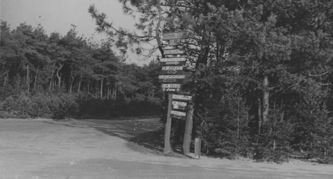
The crossroads to the Northwest has 5 roads coming together - marked in the Fliegerhorst map above with a red dot. During the German occupation this became an important crossing which was called the 'Herman Goring Platz' - referring to the Luftwaffe high commander. The sign says:
Kesselring: Zur Befehslstelle (Right), Zum Legerplatz (Right), Zu dem Unterkunfte (Left), Zum Revier (Left). Christiansen: Zum Legerplatz (Right), Zum Mun.Lager (Right).

Another map dating 31 July 1942 made by the allies of 'Woensdrecht Landing Grounds'. Comparing this map to the Fliegerhorst map reveals the same structures were the refueling points and repair hangar are noted. Flightlines and shelters are not drawn on this map.

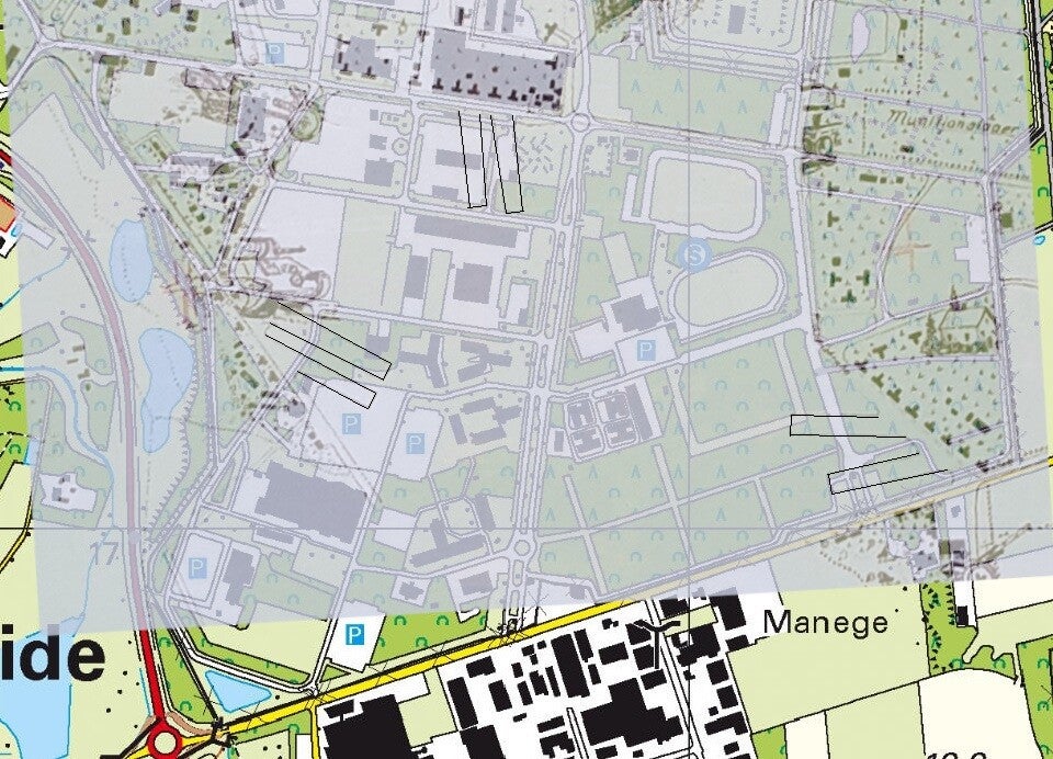
Above left a overlay of the current airbase (red) versus the old, grass airfield of 1930-1950 (yellow). The entire old airfield is currently the Southern part of Woensdrecht airbase which is used for all kind of buildings. To the right a lay over of the Fliegerhorst map with the current Southern part of Woensdrecht airbase to locate the German flightlines and shelters. The grass strip ran straight across the entire Southern part.
1945 - ww2 Allied

5-1-1945, Woensdrecht in use by the allies. The forest just above the northern road is partly levelled. The road running Northeast from the Herman Goring platz has still FlaK revetments - which can also be seen to the east of this road.
The visible runway is an allied built Perforated Steel Planking. The three pairs of dark patches are hardened (German ww2) aircraft flightlines; many Spirfires can be seen parked on or besides them - at least 42 aircraft fighter shapes can be counted on this photograph.

Close up of the PSP metal plated runway. Anotther marked grass runwat ca be seen running from Northwest to the Southeast crossing the PSP main runway.
All the way to the South, beneath the Southwestern end of the PSP main runway, were fighter revetments constructed.
1949 - post ww2; early KLu

Woensdrecht airbase July 1949. The airfield is in use by the KLu and used by Tiger Moths for pilot training. The deforested area above the northern road has now three large hangars on them for the Tiger Moths. The ww2 German FlaK revetments can also be seen clearly, as well as one double flightline - several Tiger Motsh are visible.
